#remote-sensing

icon subthematics
The Ancient Nasca World
Category

Ebooks

The Ancient Nasca World

0009172

The Ancient Nasca World Alternate Text
Category

Ebooks

Science de la nature

The Ancient Nasca World

0009172

Book

673 pages

Flag

English

The Roles of Remote Sensing in Nature Conservation
Category

Ebooks

The Roles of Remote Sensing in Nature Conservation

The Roles of Remote Sensing in Nature Conservation Alternate Text
Category

Ebooks

Ecologie

The Roles of Remote Sensing in Nature Conservation

Book

316 pages

Flag

English

Map Work
Category

Ebooks

Map Work

Thea Schoeman

Map Work Alternate Text
Category

Ebooks

Géographie

Map Work

Thea Schoeman

Book

166 pages

Flag

English

Die Auswirkungen der Fernerkundung auf das Europäische Statistische Informationssystem
Category

Documents

Die Auswirkungen der Fernerkundung auf das Europäische Statistische Informationssystem

Eurostat European Commission

Die Auswirkungen der Fernerkundung auf das Europäische Statistische Informationssystem Alternate Text
Category

Documents

Die Auswirkungen der Fernerkundung auf das Europäische Statistische Informationssystem

Eurostat European Commission

Book

192 pages

Flag

Deutsch

Aplicación de la teledetección en un estudio del pasado a una escala inter-regional. El caso de los “corrales de indios”. (Remote sensing applied to the study of the past on a scale inter-regional)
Category

Documents

Aplicación de la teledetección en un estudio del pasado a una escala inter-regional. El caso de los “corrales de indios”. (Remote sensing applied to the study of the past on a scale inter-regional)

Bognanni F.
Aplicación de la teledetección en un estudio del pasado a una escala inter-regional. El caso de los “corrales de indios”. (Remote sensing applied to the study of the past on a scale inter-regional) Alternate Text
Category

Documents

Autres

Aplicación de la teledetección en un estudio del pasado a una escala inter-regional. El caso de los “corrales de indios”. (Remote sensing applied to the study of the past on a scale inter-regional)

Bognanni F.

Book

20 pages

Flag

Español

Estudio de casos para detección y análisis de fenómenos naturales con imágenes de SEVIRI, MODIS y LANDSAT TM 5: emisiones volcánicas, ciclogénesis explosivas y grandes incendios forestales. (Detection and analysis of natural phenomena based on SEVIRI, MODIS AND LANDSAT TM 5 images: volcanic emissions, explosive cyclogenesis and great forest fires case studies)
Category

Documents

Estudio de casos para detección y análisis de fenómenos naturales con imágenes de SEVIRI, MODIS y LANDSAT TM 5: emisiones volcánicas, ciclogénesis explosivas y grandes incendios forestales. (Detection and analysis of natural phenomena based on SEVIRI, MODIS AND LANDSAT TM 5 images: volcanic emissions, explosive cyclogenesis and great forest fires case studies)

Nieto

Estudio de casos para detección y análisis de fenómenos naturales con imágenes de SEVIRI, MODIS y LANDSAT TM 5: emisiones volcánicas, ciclogénesis explosivas y grandes incendios forestales. (Detection and analysis of natural phenomena based on SEVIRI, MODIS AND LANDSAT TM 5 images: volcanic emissions, explosive cyclogenesis and great forest fires case studies) Alternate Text
Category

Documents

Autres

Estudio de casos para detección y análisis de fenómenos naturales con imágenes de SEVIRI, MODIS y LANDSAT TM 5: emisiones volcánicas, ciclogénesis explosivas y grandes incendios forestales. (Detection and analysis of natural phenomena based on SEVIRI, MODIS AND LANDSAT TM 5 images: volcanic emissions, explosive cyclogenesis and great forest fires case studies)

Nieto

Book

37 pages

Flag

L impatto del telerilevamento sui sistemi statistici europei
Category

Documents

L'impatto del telerilevamento sui sistemi statistici europei

European Commission Eurostat

L impatto del telerilevamento sui sistemi statistici europei Alternate Text
Category

Documents

L'impatto del telerilevamento sui sistemi statistici europei

European Commission Eurostat

Book

264 pages

Flag

Italiano

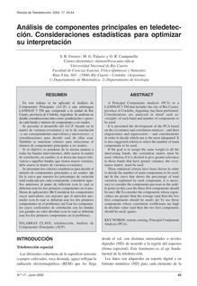
Análisis de componentes principales en teledetección. Consideraciones estadísticas para optimizar su interpretación
Category

Documents

Análisis de componentes principales en teledetección. Consideraciones estadísticas para optimizar su interpretación

S.

Análisis de componentes principales en teledetección. Consideraciones estadísticas para optimizar su interpretación Alternate Text
Category

Documents

Autres

Análisis de componentes principales en teledetección. Consideraciones estadísticas para optimizar su interpretación

S.

Book

12 pages

Flag

Español

Cartografiado de la Vid con datos Landsat-TM. Aplicación a una Zona de Tomelloso (Ciudad Real)
Category

Documents

Cartografiado de la Vid con datos Landsat-TM. Aplicación a una Zona de Tomelloso (Ciudad Real)

E. Rubio

Cartografiado de la Vid con datos Landsat-TM. Aplicación a una Zona de Tomelloso (Ciudad Real) Alternate Text
Category

Documents

Autres

Cartografiado de la Vid con datos Landsat-TM. Aplicación a una Zona de Tomelloso (Ciudad Real)

E. Rubio

Book

8 pages

Flag

Español

Detección y reconocimiento de estructuras oceánicas en imágenes AVHRR en el área de las Islas Canarias y NO de Africa mediante técnicas de computación conexionista
Category

Documents

Detección y reconocimiento de estructuras oceánicas en imágenes AVHRR en el área de las Islas Canarias y NO de Africa mediante técnicas de computación conexionista

J.

Detección y reconocimiento de estructuras oceánicas en imágenes AVHRR en el área de las Islas Canarias y NO de Africa mediante técnicas de computación conexionista Alternate Text
Category

Documents

Autres

Detección y reconocimiento de estructuras oceánicas en imágenes AVHRR en el área de las Islas Canarias y NO de Africa mediante técnicas de computación conexionista

J.

Book

7 pages

Flag

Español

FOMFIS, un sistema para la cartografía de combustibles forestales a partir de imágenes de satélite de alta resolucion
Category

Documents

FOMFIS, un sistema para la cartografía de combustibles forestales a partir de imágenes de satélite de alta resolucion

M., 2., B.

FOMFIS, un sistema para la cartografía de combustibles forestales a partir de imágenes de satélite de alta resolucion Alternate Text
Category

Documents

Autres

FOMFIS, un sistema para la cartografía de combustibles forestales a partir de imágenes de satélite de alta resolucion

M., 2., B.

Book

5 pages

Flag

Español

Estimación mediante Imágenes MERIS de la Detracción de Agua debida al Regadío (Use of MERIS Imagery for the Estimation of Water Abstraction due to Irrigation)
Category

Documents

Estimación mediante Imágenes MERIS de la Detracción de Agua debida al Regadío (Use of MERIS Imagery for the Estimation of Water Abstraction due to Irrigation)

J.

Estimación mediante Imágenes MERIS de la Detracción de Agua debida al Regadío (Use of MERIS Imagery for the Estimation of Water Abstraction due to Irrigation) Alternate Text
Category

Documents

Autres

Estimación mediante Imágenes MERIS de la Detracción de Agua debida al Regadío (Use of MERIS Imagery for the Estimation of Water Abstraction due to Irrigation)

J.

Book

15 pages

Flag

Español

Contribución de la teledetección a la oceanografía operacional desde CREPAD
Category

Documents

Contribución de la teledetección a la oceanografía operacional desde CREPAD

N. Domínguez-Barroso

Contribución de la teledetección a la oceanografía operacional desde CREPAD Alternate Text
Category

Documents

Autres

Contribución de la teledetección a la oceanografía operacional desde CREPAD

N. Domínguez-Barroso

Book

5 pages

Flag

Español

Aplicación del canal WV al estudio de un fenómeno convectivo
Category

Documents

Aplicación del canal WV al estudio de un fenómeno convectivo

M. Vázquez

Aplicación del canal WV al estudio de un fenómeno convectivo Alternate Text
Category

Documents

Autres

Aplicación del canal WV al estudio de un fenómeno convectivo

M. Vázquez

Book

4 pages

Flag

Español

La ecuación de Penman-Monteith para su uso en teledetección
Category

Documents

La ecuación de Penman-Monteith para su uso en teledetección

R. Rivas

La ecuación de Penman-Monteith para su uso en teledetección Alternate Text
Category

Documents

Autres

La ecuación de Penman-Monteith para su uso en teledetección

R. Rivas

Book

8 pages

Flag

Español

Optimization of supervised classification procedure for irrigated crop discrimination using Landsat TM images
Category

Documents

Optimization of supervised classification procedure for irrigated crop discrimination using Landsat TM images

M.

Optimization of supervised classification procedure for irrigated crop discrimination using Landsat TM images Alternate Text
Category

Documents

Autres

Optimization of supervised classification procedure for irrigated crop discrimination using Landsat TM images

M.

Book

8 pages

Flag

Español

Caracterización de vías rurales a partir de la visualización de imágenes Landsat TM y Spot P
Category

Documents

Caracterización de vías rurales a partir de la visualización de imágenes Landsat TM y Spot P

M.L. Gil-Docampo

Caracterización de vías rurales a partir de la visualización de imágenes Landsat TM y Spot P Alternate Text
Category

Documents

Autres

Caracterización de vías rurales a partir de la visualización de imágenes Landsat TM y Spot P

M.L. Gil-Docampo

Book

12 pages

Flag

Español

VALIDACION DE UN MODELO 3D PARA LA ESTIMACIÓN DE RADIACIÓN INTERCEPTADA EN CUBIERTAS HETEROGÉNEAS MEDIANTE IMÁGENES DE ALTA RESOLUCIÓN ESPACIAL (3D model validation to estimate interceptedradiation using high spatial resolution imagery in row-tree canopies)
Category

Documents

VALIDACION DE UN MODELO 3D PARA LA ESTIMACIÓN DE RADIACIÓN INTERCEPTADA EN CUBIERTAS HETEROGÉNEAS MEDIANTE IMÁGENES DE ALTA RESOLUCIÓN ESPACIAL (3D model validation to estimate interceptedradiation using high spatial resolution imagery in row-tree canopies)

M.

VALIDACION DE UN MODELO 3D PARA LA ESTIMACIÓN DE RADIACIÓN INTERCEPTADA EN CUBIERTAS HETEROGÉNEAS MEDIANTE IMÁGENES DE ALTA RESOLUCIÓN ESPACIAL (3D model validation to estimate interceptedradiation using high spatial resolution imagery in row-tree canopies) Alternate Text
Category

Documents

Autres

VALIDACION DE UN MODELO 3D PARA LA ESTIMACIÓN DE RADIACIÓN INTERCEPTADA EN CUBIERTAS HETEROGÉNEAS MEDIANTE IMÁGENES DE ALTA RESOLUCIÓN ESPACIAL (3D model validation to estimate interceptedradiation using high spatial resolution imagery in row-tree canopies)

M.

Book

9 pages

Flag

Español

Una metodología práctica de generación de información de imágenes de percepción remota para los SIG
Category

Documents

Una metodología práctica de generación de información de imágenes de percepción remota para los SIG

E. Pernía

Una metodología práctica de generación de información de imágenes de percepción remota para los SIG Alternate Text
Category

Documents

Autres

Una metodología práctica de generación de información de imágenes de percepción remota para los SIG

E. Pernía

Book

7 pages

Flag

Español

VALIDACIÓN DE LA LOCALIZACIÓN DE INCENDIOS MEDIANTE “GLOBAL FIRE EMAIL ALERTS [BETA] ” EN ÁREAS CON CLIMA MEDITERRÁNEO (Validation of forest fire location by global fire email alerts [BETA] in mediterranean areas)
Category

Documents

VALIDACIÓN DE LA LOCALIZACIÓN DE INCENDIOS MEDIANTE “GLOBAL FIRE EMAIL ALERTS [BETA] ” EN ÁREAS CON CLIMA MEDITERRÁNEO (Validation of forest fire location by global fire email alerts [BETA] in mediterranean areas)

R.
VALIDACIÓN DE LA LOCALIZACIÓN DE INCENDIOS MEDIANTE “GLOBAL FIRE EMAIL ALERTS [BETA] ” EN ÁREAS CON CLIMA MEDITERRÁNEO (Validation of forest fire location by global fire email alerts [BETA] in mediterranean areas) Alternate Text
Category

Documents

Autres

VALIDACIÓN DE LA LOCALIZACIÓN DE INCENDIOS MEDIANTE “GLOBAL FIRE EMAIL ALERTS [BETA] ” EN ÁREAS CON CLIMA MEDITERRÁNEO (Validation of forest fire location by global fire email alerts [BETA] in mediterranean areas)

R.

Book

5 pages

Flag

Español

ESTUDIO DEL CRECIMIENTO URBANO, DE LA ESTRUCTURA DE LA VEGETACIÓN Y DE LA TEMPERATURA DE LA SUPERFICIE DEL GRAN SAN MIGUEL DE TUCUMÁN, ARGENTINA (Study of the urban growing, the vegetationstructure and the land surface temperature of the Gran San Miguel de Tucumán, Argentina)
Category

Documents

ESTUDIO DEL CRECIMIENTO URBANO, DE LA ESTRUCTURA DE LA VEGETACIÓN Y DE LA TEMPERATURA DE LA SUPERFICIE DEL GRAN SAN MIGUEL DE TUCUMÁN, ARGENTINA (Study of the urban growing, the vegetationstructure and the land surface temperature of the Gran San Miguel de Tucumán, Argentina)

R. Oltra-Carrió

ESTUDIO DEL CRECIMIENTO URBANO, DE LA ESTRUCTURA DE LA VEGETACIÓN Y DE LA TEMPERATURA DE LA SUPERFICIE DEL GRAN SAN MIGUEL DE TUCUMÁN, ARGENTINA (Study of the urban growing, the vegetationstructure and the land surface temperature of the Gran San Miguel de Tucumán, Argentina) Alternate Text
Category

Documents

Autres

ESTUDIO DEL CRECIMIENTO URBANO, DE LA ESTRUCTURA DE LA VEGETACIÓN Y DE LA TEMPERATURA DE LA SUPERFICIE DEL GRAN SAN MIGUEL DE TUCUMÁN, ARGENTINA (Study of the urban growing, the vegetationstructure and the land surface temperature of the Gran San Miguel de Tucumán, Argentina)

R. Oltra-Carrió

Book

8 pages

Flag

Español

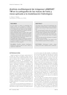
Análisis multitemporal de imágenes LANDSAT TM en la cartografía de las masas de hielo y nieve aplicada a la modelización hidrológica
Category

Documents

Análisis multitemporal de imágenes LANDSAT TM en la cartografía de las masas de hielo y nieve aplicada a la modelización hidrológica

C. Alonso
Análisis multitemporal de imágenes LANDSAT TM en la cartografía de las masas de hielo y nieve aplicada a la modelización hidrológica Alternate Text
Category

Documents

Autres

Análisis multitemporal de imágenes LANDSAT TM en la cartografía de las masas de hielo y nieve aplicada a la modelización hidrológica

C. Alonso

Book

12 pages

Flag

Español

L impact de la télédétection sur le système d information statistique en Europe
Category

Documents

L'impact de la télédétection sur le système d'information statistique en Europe

European Commission Eurostat

L impact de la télédétection sur le système d information statistique en Europe Alternate Text
Category

Documents

Techniques

L'impact de la télédétection sur le système d'information statistique en Europe

European Commission Eurostat

Book

276 pages

Flag

Français

Intelligent Systems for Environmental Applications
Category

Documents

Intelligent Systems for Environmental Applications

European Commission Directorate-General For The Information Society And Media

Intelligent Systems for Environmental Applications Alternate Text
Category

Documents

Science de la nature

Intelligent Systems for Environmental Applications

European Commission Directorate-General For The Information Society And Media

Book

4 pages

Flag

English

Evaluation of the remote sensing programme of the Joint Research Centre
Category

Documents

Evaluation of the remote sensing programme of the Joint Research Centre

Joint Research Centre European Commission Directorate-General For The Information Society And Media

Evaluation of the remote sensing programme of the Joint Research Centre Alternate Text
Category

Documents

Science de la nature

Evaluation of the remote sensing programme of the Joint Research Centre

Joint Research Centre European Commission Directorate-General For The Information Society And Media

Book

114 pages

Flag

English

Classification by diagnosing all absorption features (CDAF) for the most abundant minerals in airborne hyperspectral images
Category

Documents

Classification by diagnosing all absorption features (CDAF) for the most abundant minerals in airborne hyperspectral images

Mobasheri Mohammad, Ghamary-Asl, Ghamary-Asl Mohsen

Classification by diagnosing all absorption features (CDAF) for the most abundant minerals in airborne hyperspectral images Alternate Text
Category

Documents

Savoirs

Classification by diagnosing all absorption features (CDAF) for the most abundant minerals in airborne hyperspectral images

Mobasheri Mohammad, Ghamary-Asl, Ghamary-Asl Mohsen

Book

7 pages

Flag

English

Remote sensing-based time series models for malaria early warning in the highlands of Ethiopia
Category

Documents

Remote sensing-based time series models for malaria early warning in the highlands of Ethiopia

Midekisa Alemayehu, Senay Gabriel, Henebry, Semuniguse Paulos, Wimberly

Remote sensing-based time series models for malaria early warning in the highlands of Ethiopia Alternate Text
Category

Documents

Savoirs

Remote sensing-based time series models for malaria early warning in the highlands of Ethiopia

Midekisa Alemayehu, Senay Gabriel, Henebry, Semuniguse Paulos, Wimberly

Book

10 pages

Flag

English

Schistosomiasis transmission and environmental change: a spatio-temporal analysis in Porto de Galinhas, Pernambuco - Brazil
Category

Documents

Schistosomiasis transmission and environmental change: a spatio-temporal analysis in Porto de Galinhas, Pernambuco - Brazil

Barbosa, Leal-Neto Onicio, Albuquerque Jones, Barbosa Constança, Silva, Gomes

Schistosomiasis transmission and environmental change: a spatio-temporal analysis in Porto de Galinhas, Pernambuco - Brazil Alternate Text
Category

Documents

Savoirs

Schistosomiasis transmission and environmental change: a spatio-temporal analysis in Porto de Galinhas, Pernambuco - Brazil

Barbosa, Leal-Neto Onicio, Albuquerque Jones, Barbosa Constança, Silva, Gomes

Book

11 pages

Flag

English

A sample design for globally consistent biomass estimation using lidar data from the Geoscience Laser Altimeter System (GLAS)
Category

Documents

A sample design for globally consistent biomass estimation using lidar data from the Geoscience Laser Altimeter System (GLAS)

Healey, Patterson, Saatchi Sassan, Lefsky, Freeman, Lister

A sample design for globally consistent biomass estimation using lidar data from the Geoscience Laser Altimeter System (GLAS) Alternate Text
Category

Documents

Savoirs

A sample design for globally consistent biomass estimation using lidar data from the Geoscience Laser Altimeter System (GLAS)

Healey, Patterson, Saatchi Sassan, Lefsky, Freeman, Lister

Book

9 pages

Flag

English

Characterizing the interface between wild ducks and poultry to evaluate the potential of transmission of avian pathogens
Category

Documents

Characterizing the interface between wild ducks and poultry to evaluate the potential of transmission of avian pathogens

Cappelle Julien, Gaidet Nicolas, Iverson, Takekawa, Newman, Fofana Bouba, Gilbert Marius, Gilbert

Characterizing the interface between wild ducks and poultry to evaluate the potential of transmission of avian pathogens Alternate Text
Category

Documents

Savoirs

Characterizing the interface between wild ducks and poultry to evaluate the potential of transmission of avian pathogens

Cappelle Julien, Gaidet Nicolas, Iverson, Takekawa, Newman, Fofana Bouba, Gilbert Marius, Gilbert

Book

9 pages

Flag

English

Alternate Text