-
 Univers
-
 Ebooks
-
 Livres audio
-
 Presse
-
 Podcasts
-
 BD
BD
-
 Documents
-
- Cours
- Révisions
- Ressources pédagogiques
- Sciences de l’éducation
- Manuels scolaires
- Langues
- Travaux de classe
- Annales de BEP
- Etudes supérieures
- Maternelle et primaire
- Fiches de lecture
- Orientation scolaire
- Méthodologie
- Corrigés de devoir
- Annales d’examens et concours
- Annales du bac
- Annales du brevet
- Rapports de stage
La lecture à portée de main
#lidar
Suivre

Documents
Tropopause and Cirrus Clouds Tops Heights
Susan


Documents
Estructura vertical de las invasiones de polvo mineral sobre las Islas Canarias durante 2004
A.M. Díaz

Documents
Autres
Estructura vertical de las invasiones de polvo mineral sobre las Islas Canarias durante 2004
A.M. Díaz
6 pages
Español

Documents
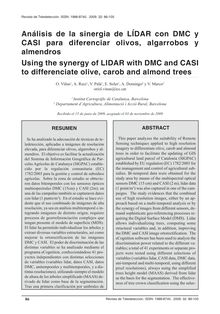
ANÁLISIS DE LA SINERGIA DE LIDAR CON DMC Y CASI PARA DIFERENCIAR OLIVOS, ALGARROBOS Y ALMENDROS (Using the synergy of LIDAR with Dmc and CASI to differenciate olive, carob and almond trees)
O. Viñas

Documents
Autres
ANÁLISIS DE LA SINERGIA DE LIDAR CON DMC Y CASI PARA DIFERENCIAR OLIVOS, ALGARROBOS Y ALMENDROS (Using the synergy of LIDAR with Dmc and CASI to differenciate olive, carob and almond trees)
O. Viñas
20 pages
Español

Documents
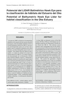
POTENCIAL DEL LIDAR BATIMÉTRICO HAWK EYE PARA LA CLASIFICACIÓN DE HÁBITATS DEL ESTUARIO DEL OKA (Potential of Bathymetric Hawk Eye Lidar for habitat classification in the Oka Estuary)
G. Chust, 48395, M. Grande, R. Moncho, I. Galparsoro

Documents
Autres
POTENCIAL DEL LIDAR BATIMÉTRICO HAWK EYE PARA LA CLASIFICACIÓN DE HÁBITATS DEL ESTUARIO DEL OKA (Potential of Bathymetric Hawk Eye Lidar for habitat classification in the Oka Estuary)
G. Chust, 48395, M. Grande, R. Moncho, I. Galparsoro
6 pages
Español

Documents
ESTIMACIÓN Y CARTOGRAFÍA DE PARÁMETROS ECOLÓGICOS Y FORESTALES EN TRES ESPECIES (QUERCUS ILEX L. SUBSP ILEX, FAGUS SYLVATICA L. Y PINUS HALEPENSIS L.) CON DATOS LIDAR (Estimation and mapping forest and ecological parameters for three tree species (Quercus ilex L. subsp. ilex, Fagus sylvatica L. and Pinus halepensis L.) with LIDAR data
V. Zaldo

Documents
Autres
ESTIMACIÓN Y CARTOGRAFÍA DE PARÁMETROS ECOLÓGICOS Y FORESTALES EN TRES ESPECIES (QUERCUS ILEX L. SUBSP ILEX, FAGUS SYLVATICA L. Y PINUS HALEPENSIS L.) CON DATOS LIDAR (Estimation and mapping forest and ecological parameters for three tree species (Quercus ilex L. subsp. ilex, Fagus sylvatica L. and Pinus halepensis L.) with LIDAR data
V. Zaldo
14 pages
Español

Documents
CLASIFICACIÓN DE CULTIVOS EN LA ZONA MEDIA DE NAVARRA MEDIANTE IMÁGENES RADAR POLARIMÉTRICAS (
A. Larrañaga

Documents
Autres
CLASIFICACIÓN DE CULTIVOS EN LA ZONA MEDIA DE NAVARRA MEDIANTE IMÁGENES RADAR POLARIMÉTRICAS (
A. Larrañaga
12 pages
Español

Documents
DETECCIÓN AUTOMÁTICA DE EDIFICIOS MEDIANTE IMÁGENES DE ALTA RESOLUCIÓN Y DATOS LIDAR PARA LA ACTUALIZACIÓN DE BASES DE DATOS (Automatic building location using high resolution images and Lidar data for land use/land cover geospatial database updating in urban environments)
T. Hermosilla

Documents
Autres
DETECCIÓN AUTOMÁTICA DE EDIFICIOS MEDIANTE IMÁGENES DE ALTA RESOLUCIÓN Y DATOS LIDAR PARA LA ACTUALIZACIÓN DE BASES DE DATOS (Automatic building location using high resolution images and Lidar data for land use/land cover geospatial database updating in urban environments)
T. Hermosilla
5 pages
Español

Documents
A sample design for globally consistent biomass estimation using lidar data from the Geoscience Laser Altimeter System (GLAS)
Healey, Patterson, Saatchi Sassan, Lefsky, Freeman, Lister

Documents
Savoirs
A sample design for globally consistent biomass estimation using lidar data from the Geoscience Laser Altimeter System (GLAS)
Healey, Patterson, Saatchi Sassan, Lefsky, Freeman, Lister
9 pages
English

Documents
Human and environmental controls over aboveground carbon storage in Madagascar
Asner, Mascaro Joseph, Vaudry Romuald, Chadwick, Vieilledent Ghislain, Rasamoelina Maminiaina, Balaji Aravindh, Kennedy-Bowdoin Ty, Maatoug Léna, Colgan, Clark, Knapp

Documents
Savoirs
Human and environmental controls over aboveground carbon storage in Madagascar
Asner, Mascaro Joseph, Vaudry Romuald, Chadwick, Vieilledent Ghislain, Rasamoelina Maminiaina, Balaji Aravindh, Kennedy-Bowdoin Ty, Maatoug Léna, Colgan, Clark, Knapp
13 pages
English

Documents
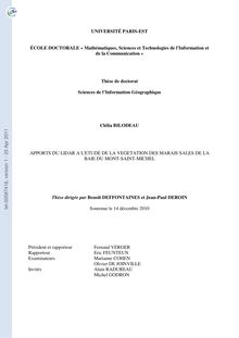
Apports du LiDAR à l'étude de la végétation des marais salés de la baie du Mont-Saint-Michel, The use of LiDAR to study salt marshes vegetation in the Mont-Saint-Michel Bay (France)
Clélia Bilodeau

Documents
Savoirs
Apports du LiDAR à l'étude de la végétation des marais salés de la baie du Mont-Saint-Michel, The use of LiDAR to study salt marshes vegetation in the Mont-Saint-Michel Bay (France)
Clélia Bilodeau
209 pages
Français
Collection
{{collectionTitle}}
Collection
{{collectionTitle}}
Collection
{{collectionTitle}}
{{productCategoryLabel}}
{{productTitle}}
{{productAuthors}}
{{productCategoryLabel}}
{{productThemeLabel}}
{{productTitle}}
{{productAuthors}}
{{productPages}}
{{productLanguageIsoCode}}
-
 Univers
-
 Ebooks
-
 Livres audio
-
 Presse
-
 Podcasts
-
 BD
BD
-
 Documents
-
Jeunesse
-
Littérature
-
Ressources professionnelles
-
Santé et bien-être
-
Savoirs
-
Education
-
Loisirs et hobbies
-
Art, musique et cinéma
-
Actualité et débat de société
-
Jeunesse
-
Littérature
-
Ressources professionnelles
-
Santé et bien-être
-
Savoirs
-
Education
-
Loisirs et hobbies
-
Art, musique et cinéma
-
Actualité et débat de société
-
Actualités
-
Lifestyle
-
Presse jeunesse
-
Presse professionnelle
-
Pratique
-
Presse sportive
-
Presse internationale
-
Culture & Médias
-
Action et Aventures
-
Science-fiction et Fantasy
-
Société
-
Jeunesse
-
Littérature
-
Ressources professionnelles
-
Santé et bien-être
-
Savoirs
-
Education
-
Loisirs et hobbies
-
Art, musique et cinéma
-
Actualité et débat de société
- Cours
- Révisions
- Ressources pédagogiques
- Sciences de l’éducation
- Manuels scolaires
- Langues
- Travaux de classe
- Annales de BEP
- Etudes supérieures
- Maternelle et primaire
- Fiches de lecture
- Orientation scolaire
- Méthodologie
- Corrigés de devoir
- Annales d’examens et concours
- Annales du bac
- Annales du brevet
- Rapports de stage


